Cardada Cemita

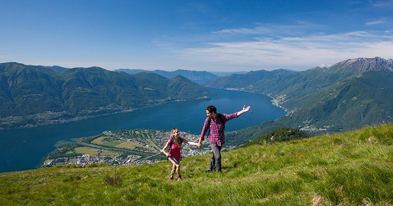
Who does not know Lake Maggiore by name? But did you know that at the northern end of the lake near Locarno, you will enjoy the lowest and highest points in Switzerland? Cardada Cimetta is located just above Locarno. When you stand on top of Mount Chimita at 1,670 metres, you will have a view of the lowest point (Lago Maggiore) and the highest point in Switzerland (Duforspitz-Monte Rosa).
From Orselina, the Cardada cable car takes you to Cardada Peak at 1,340 metres. A two-person chairlift takes you to the summit of Cimetta at 1,670 metres. Here you can wander for hours on mountain hiking trails or find more of a challenge during longer treks to the surrounding mountain peaks. Cardada is located exactly between two valleys where you can enjoy beautiful walks. On one side you will find Valle di Maggia and on the other side you will find Valle Verzasca. Various hiking trails in Cardada connect these two valleys.
-
Circular walk Cimetta: From Cimetta follow the path to the top of Cima della Trosa. The first half of the climb is flat and runs through an arc along the west side of Cimetta. You only make the most upside in the second half. At the top you can enjoy the beautiful view. On the way back, you will walk along the eastern side of Cimetta and come across several mountain huts where you can enjoy a well-deserved rest before continuing to the end of the road.
- Start Stage 1 – Via Alta Vallimagia:
This 200 km route is a tip for those who like a tough challenge. You can walk through the entire Ticino region in 19 stages. And the first stage begins, yes… on top of the Simita!
more information
Centero del Monte Generoso

At the southern tip of Ticino, at the foot of Lake Lugano, you'll find another secret pearl: Monte Generoso. The top of this mountain is located exactly on the border of Ticino, Switzerland, and Lombardy, Italy. What few people know is that you can take beautiful walks here. Our tip: Sentiero del Monte Generoso.
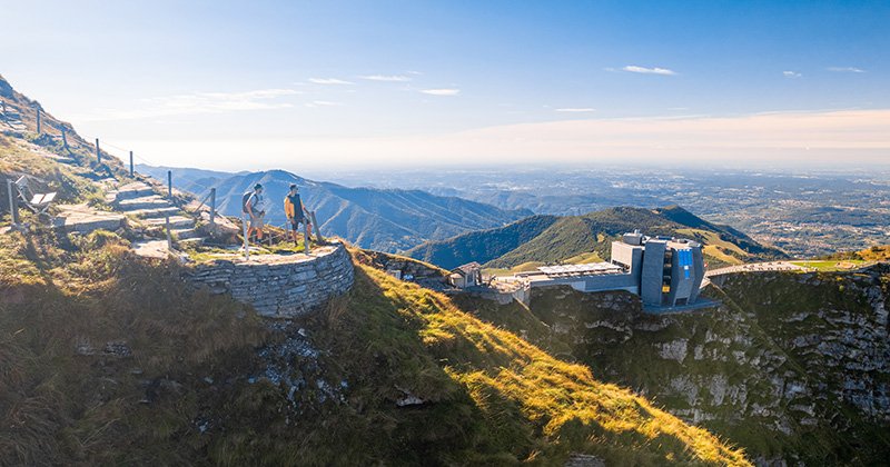
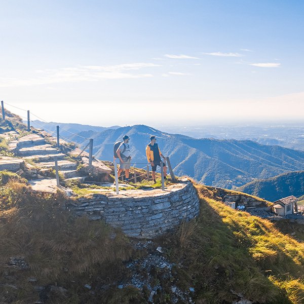
This enjoyable 9 km walk starts from Bellavista Central Station, arriving from Capolago via the cogwheel railway from 1890. You cross under the train track and follow the narrow path to the Alpe Nadig. First you descend gently into Alpe Gènor. Here you will still find parts of Nevers. An ancient refrigeration system, in which snow and ice are stored underground and used as refrigeration to store milk and cheese. Once you pass here, the climbing begins and you walk via Piana to the summit of Mount Generoso, which is 1,701 meters high. Take a moment and see the lakes you know from afar. And whether you can discover the amazing peaks, for example, Gran Paradiso, Monte Rosa and the Matterhorn.
While you're here, you can't ignore the imposing Fiore di Pietra building, which stands at the top like a surreal spaceship. After visiting the exhibition on railway history, continue the walking route and reach Alp Clericetti where you have a perfect view of the Valle di Muggio, the southernmost valley in Switzerland. Continue on the road until you reach Bellavista. There you take the train back to the valley.
All hiking tips
Discover Ticino
Can't wait to discover the rocks of Ticino for yourself? For more information, accommodation, activities and events, visit the website of your local tourism office.
more information

Zombie specialist. Friendly twitter guru. Internet buff. Organizer. Coffee trailblazer. Lifelong problem solver. Certified travel enthusiast. Alcohol geek.

