advertisement

Exciting weather forecast for the coming days. Winter rains are expected to fall in our country at the beginning of the week. On Monday, winter-like rain showers will move from the northwest, with rain falling in the form of snow. There are also chances of snow for the rest of the week. The big question is will the snow stay? If so, where and how much will it fall?
Last week we had to deal with wintry weather, as there was natural ice in places and the sun was often visible. Next week we will also see winter weather, but of a completely different kind.
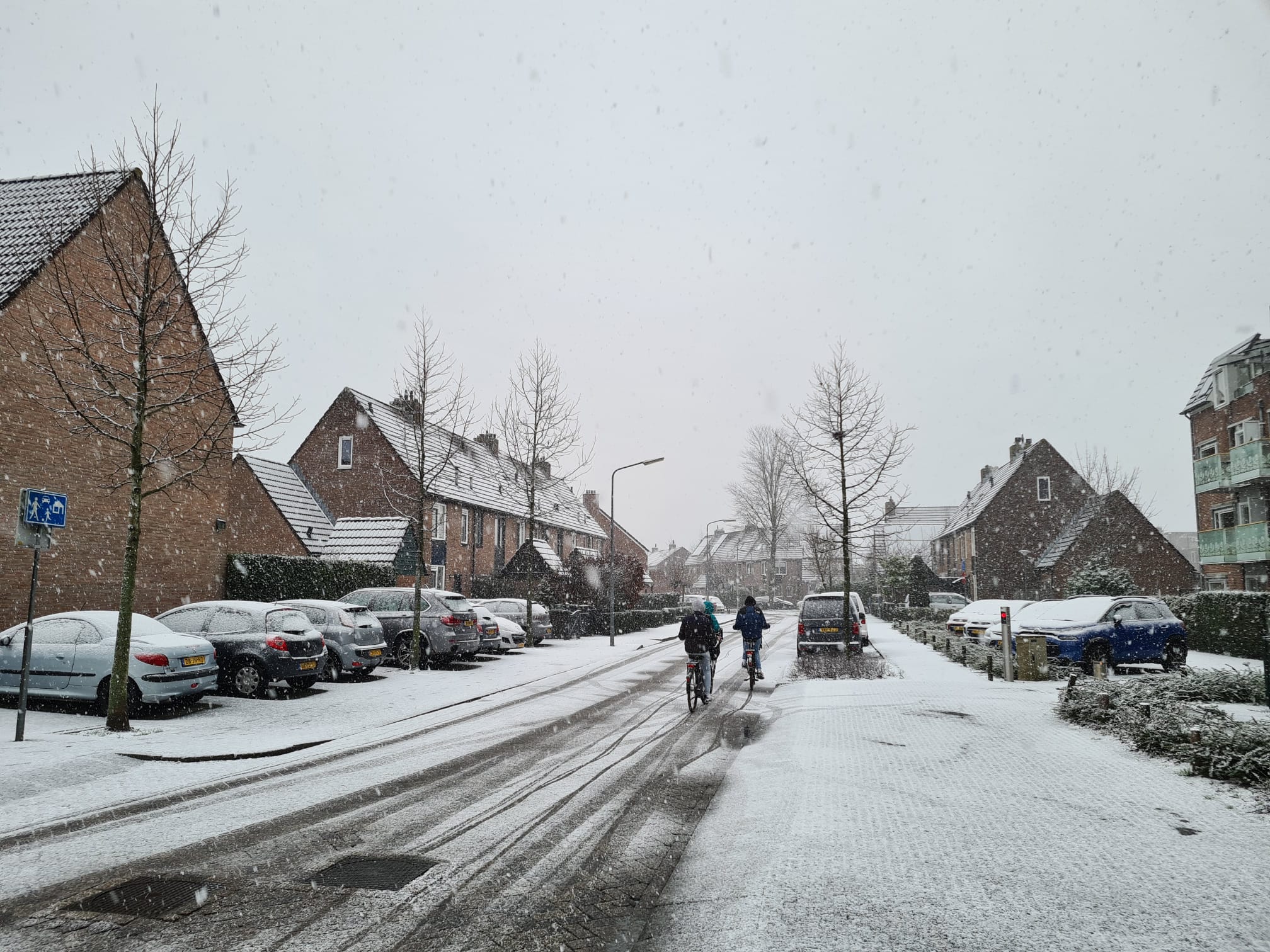

On January 20 of last year, a polar low passed over the country and caused winter rains. During heavy snowfalls, the snow remained for a short time. This time there is no polar depression, but there may be some local snow again next Monday and Tuesday. (Houses in North Holland, January 20, 2023)
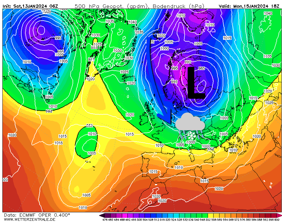

A northwesterly current will bring cold maritime air masses to our country on Monday and bring wintry rains. (ECMWF 500 hPa, via Wetterzentrale.de)
This weekend, the winds will shift to the north, and humid air will come from the North Sea, with occasional drizzle. The cold polar air will gradually descend towards our latitude. It will be cooler on Sunday than Saturday, but it will still be mainly rainy. After the weekend the temperature will drop further.
Monday (Wet) Snow, cold, wind and bright clear skies
On Monday, temperatures will drop another step and winds will shift to the northwest. Wind strength will increase, especially on the coast Wind speed reaches 50 to 60 km/hour. In addition to the winds, winter rain is also expected to pass over the country early in the morning. There is less wind inland.
In the morning the temperature is just above freezing. Precipitation will initially be wet snow, although hail and occasional thunderstorms cannot be ruled out. It will be a cool day, but between the rain showers there will occasionally be bright spells of sunshine.
Rain will intensify during the afternoon. During intense rain, snow may remain for a short time. This will be short-lived in coastal counties, but a dangerous snow cover may begin to form inland. The greatest chance of this happening is later in the afternoon and Monday evening once the soil has cooled enough. If we look at the latest model calculations from weather models, we will find that they still vary greatly.
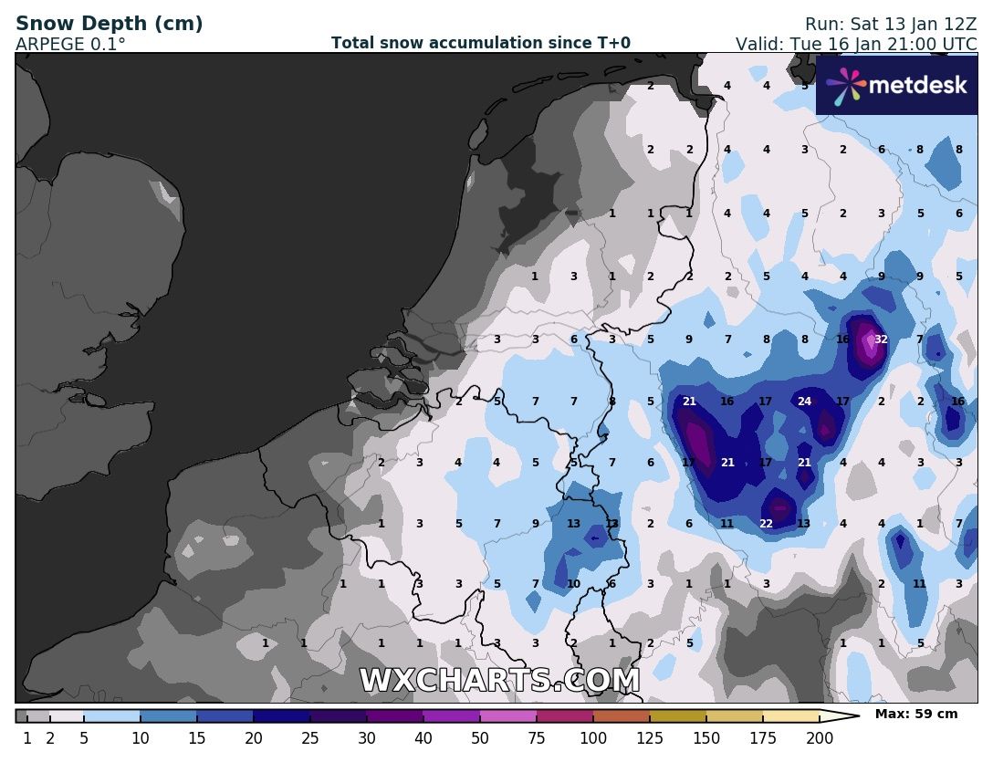

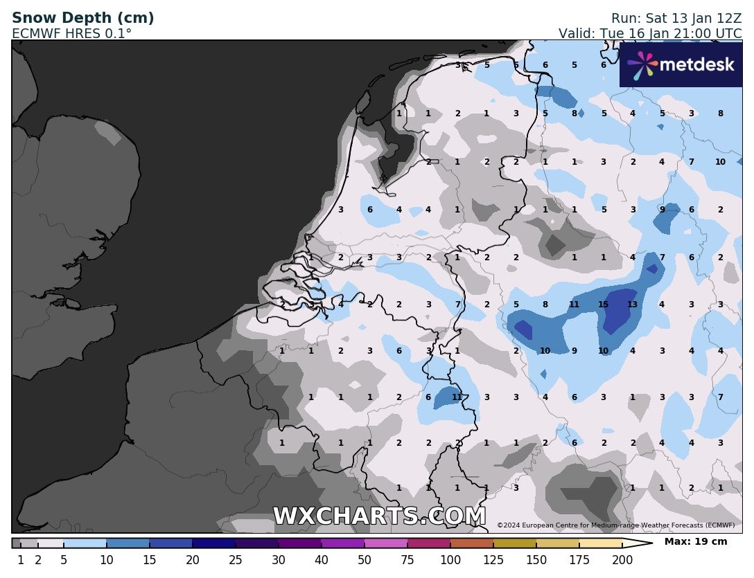

ARPEGE and ECMWF expect several centimeters of snow to fall on Monday and Tuesday (Source: WXCHARTS.com)
The ARPEGE and ECMWF weather model expects most of the snow to fall on Monday and a small amount on Tuesday. In total, more than 5 cm may fall out these days. ECMWF predicts this for the entire Benelux countries, but ARPEGE predicts this for the interior regions only. The German ICON-EU weather model and the US GFS model are less clear about snowfall and do not predict snow cover. So there is still a lot of uncertainty!
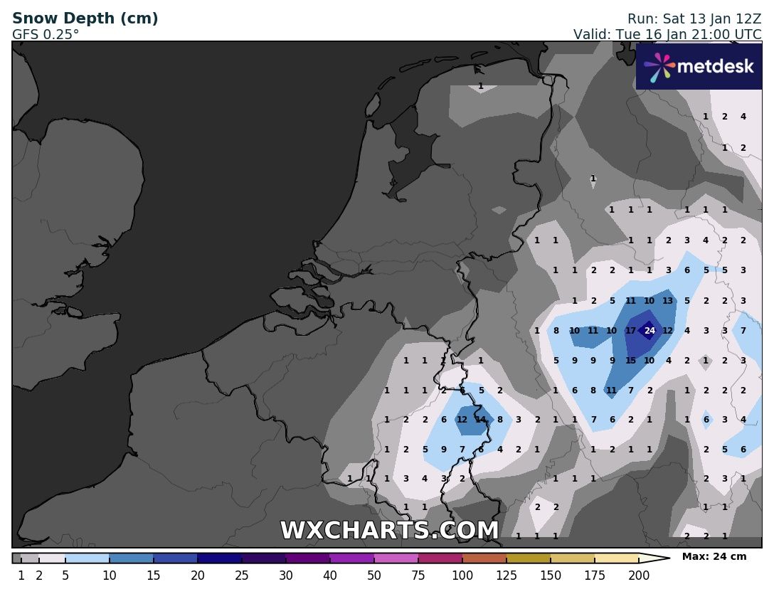

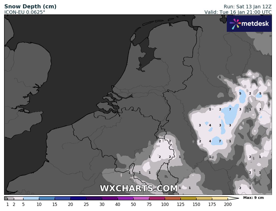

The GFS and ICON-EU model assume no snow cover on Monday and Tuesday, except in the Ardennes region (Source: WXCHARTS.com)
More snow on Wednesday and Thursday?
Some meteorological services had previously reported in recent days the presence of a large snow dump on Wednesday. It now seems that these exciting statements no longer have much impact. But it's not entirely unlikely that we will have to deal with snow again later in the week. Most weather models expect the weather to remain dry after Tuesday, but the German weather model ICON-EU calculates snowfall amounts in the southern Netherlands and Belgium at more than 10 cm. The uncertainty about the location of this precipitation area is particularly large. Most models now assume that snow will fall further south. It must also be taken into account that this occurs at the border between warm and cold air. If it's a little warmer, it will mainly rain.
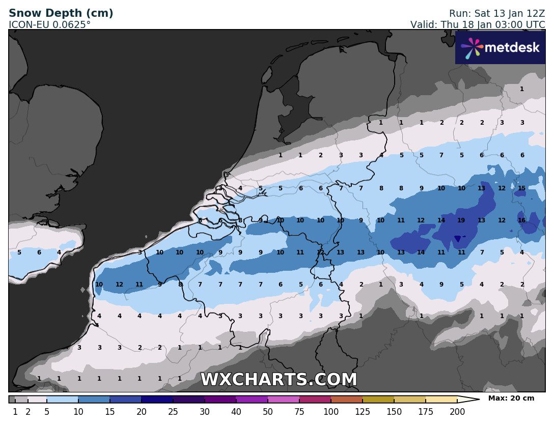

The ICON-EU model is the only model still showing a significant amount of snow on Wednesday and Thursday, but uncertainty about location and timing is large. (Source: WXCHARTS.com)
How long will we have to deal with the winter weather?
This month we had to deal with temperatures that were close to average or even below average. The weather last week was dry continental polar air and in the coming days the air will be mainly maritime polar.
Looking at the sets, it looks like the winter weather will end later in the week. Regional impacts will increase as disturbances from the Atlantic reach us. There is a good chance of heavy rain again and strong winds at times. However, this type of active weather could change again, because cold air remains close to us.
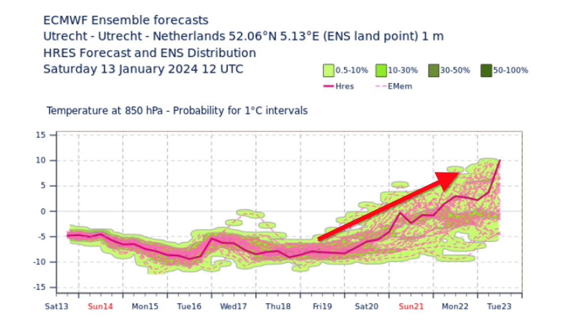

The temperature will rise again next weekend and then the winter weather will end (meteogram ECMWF, Utrecht sampling point)
In short, consider (wet) snow on Monday and Tuesday, as a thin layer of snow can form inland, which could lead to slippery conditions. The snow likely won't last long, and next weekend the cold will end again.
Are you also curious about the weather in the Alps next week? After a period of sunny and dry weather, wintry rain is also expected next week. More on that in the Alpine weather reports!
(Visited 382 times, 382 visits today)
Roy graduated from Wageningen University. As a BA he completed the Soil, Water and Atmosphere course. During his master's degree he also specialized in hydrology and meteorology. Furthermore, he has also taken several courses in Norway and conducted research in Spitsbergen. Roy writes Alpine weather reports for Alpenweerman, gives lectures on the weather and provides ski reviews at ski areas.

Zombie specialist. Friendly twitter guru. Internet buff. Organizer. Coffee trailblazer. Lifelong problem solver. Certified travel enthusiast. Alcohol geek.
